Remote Sensing
·
2014
·Vol. 6
·期 12
·12723-12751
·
IF 2.623
Alice B. Kelly,Nina Maggi Kelly
This paper explores the existing literature on the active detection of crimes using remote sensing technologies. The paper reviews sixty-one studies that use remote sensing to actively detect crime. Considering the serious consequences of misidentifying crimes or sites of crimes (e.g., opening that place and its residents up to potentially needless intrusion, intimidation, surveillance or violence), the authors were surprised to find a lack of rigorous validation of the remote sensing methods utilized in these studies. In some cases, validation was not mentioned, while in others, validation was severely hampered by security issues, rough terrain and weather conditions. The paper also considers the potential hazards of the use of Google Earth to identify crimes and criminals. The paper concludes by considering alternate, “second order” validation techniques that could add vital context and understanding to remotely sensed images in a law enforcement context. With this discussion, the authors seek to initiate a discussion on other potential “second order” validation techniques, as well as on the exponential growth of surveillance in our everyday lives.Keywords:remote sensing;crime;validation;accuracy assessment;Google Earth
研究领域:
地理学
·
刑事科学技术
·
遥感技术
✓ 已验证
DOI
高影响因子
ANALYST
·
2020
·Vol. 145
·期 15
·5307-5313
·
IF 3.978
Huan Lin,Xin Cheng,Ming-Jie Yin,Zhouzhou Bao,Xunbin Wei,Bobo Gu
With the rapid growth of anti-terrorist activities worldwide, it becomes an emerging requirement to rapidly and accurately detect hidden explosive threats. However, the safety issue during the explosive material detection, e.g. unexpected explosion, is still an insurmountable challenge. In this study, we design and mass-produce a novel kind of flexible 5,10,15,20-tetrakis(4-aminophenyl)porphyrin doped polymer optical fiber (PPOF) for rapid and accurate detection of trace 2,4-dinitrotoluene (DNT) vapor based on the DNT induced florescence quenching mechanism. The influence of doping concentration, bending, and temperature on the sensing performance is investigated. PPOF shows immunity to bending, enabling it to work in a harsh environment. It is experimentally demonstrated that the limit of detection and response time of the proposed PPOF could reach around 120 ppb and 3 minutes, respectively, which make it much better than other techniques. Owning to its inherent advantages including low-cost, remote-control capability, and compatibility with optical communication networking, PPOF can be constructed the quasi-distributed sensing networking of explosive matters in the future, providing a new strategy for anti-terrorism.
研究领域:
材料科学
·
光学工程
·
化学传感
·
安全技术
✓ 已验证
产品关联
DOI
PubMed
高影响因子
Agronomy-Basel
·
2025
·Vol. 15
·期 8
·1779
·
IF 3.4
Meichen Liu,Shengwei Zhang,Jing Gao,Bo Wang,Kedi Fang,Lu Liu,Shengwei Lv,Qian Zhang
The salinization of agricultural soils is a serious threat to farming and ecological balance in arid and semi-arid regions. Accurate estimation of soil water-soluble ions (calcium, carbonate, magnesium, and sulfate) is necessary for correct monitoring of soil salinization and sustainable land management. Hyperspectral ground-based data are valuable in soil salinization monitoring, but the acquisition cost is high, and the coverage is small. Therefore, this study proposes a two-stage deep learning framework with multispectral remote-sensing images. First, the wavelet transform is used to enhance the Transformer and extract fine-grained spectral features to reconstruct the ground-based hyperspectral data. A comparison of ground-based hyperspectral data shows that the reconstructed spectra match the measured data in the 450–998 nm range, with R2up to 0.98 and MSE = 0.31. This high similarity compensates for the low spectral resolution and weak feature expression of multispectral remote-sensing data. Subsequently, this enhanced spectral information was integrated and fed into a novel multiscale self-attentive Transformer model (MSATransformer) to invert four water-soluble ions. Compared with BPANN, MLP, and the standard Transformer model, our model remains robust across different spectra, achieving an R2of up to 0.95 and reducing the average relative error by more than 30%. Among them, for the strongly responsive ions magnesium and sulfate, R2reaches 0.92 and 0.95 (with RMSE of 0.13 and 0.29 g/kg, respectively). For the weakly responsive ions calcium and carbonate, R2stays above 0.80 (RMSE is below 0.40 g/kg). The MSATransformer framework provides a low-cost and high-accuracy solution to monitor soil salinization at large scales and supports precision farmland management.
研究领域:
遥感
·
土壤科学
·
农业监测
·
深度学习
·
环境监测
✓ 已验证
产品关联
DOI
高影响因子
ISPRS International Journal of Geo-Information
·
2020
·Vol. 9
·期 1
·20
·
IF 2.239
Yu Tian,Bingxi Liu,Yuandong Hu,Qing Xu,Ming Qu,Dawei Xu
Hemeroby is an integrated indicator used to measure the impact and degree of all human interventions on ecological components or ecosystems. The constant exploitation of resources is a strong interference of human beings to the natural environment. With the depletion of non-renewable resources, some cities with resource exploitation as their main industry—“resource-based cities”—are facing great development pressure. In order to quantify the impact of human disturbance on the natural environment and provide some scientific support for policy makers of the resource-based city, we used remote sensing images and landscape pattern metrics, introduced the synthetic hemeroby index model and analyzed the relationship between human disturbance and landscape pattern during 1990–2017. The results showed that: (1) The hemeroby in Daqing continued to rise during 1990–2017, and the main factor was the continuous expansion of the construction land and the reclamation of farmland. (2) In the areas with different hemeroby, there were significant differences in landscape pattern. In the areas with high-level hemeroby, the heterogeneity of landscape pattern was low, the aggregation among patches was high, and the shape of patches was regular, whereas the landscape pattern in the areas with medium-level hemeroby was just opposite. Although the heterogeneity of landscape pattern and the aggregation among patches were high in the areas with low-level hemeroby, the complexity of landscape was low and the shape of patches was regular. (3) In the temporal dimension, the increase of hemeroby contributed to the complexity of patch shape, the decrease of the aggregation among patches, and the fragmentation of landscape pattern. In the spatial dimension, the response in landscape pattern to human disturbance was relatively insensitive in the areas with low-level hemeroby, and this response was basically same in the high-level hemeroby and the whole study areas.
研究领域:
生态学
·
环境科学
·
城市规划
·
地理学
·
景观生态学
✓ 已验证
DOI
高影响因子
Inventions
·
2021
·Vol. 6
·期 2
·29
·
IF 0
Bhuwan Kashyap,Ratnesh Kumar
Reducing agricultural losses is an effective way to sustainably increase agricultural output efficiency to meet our present and future needs for food, fiber, fodder, and fuel. Our ever-improving understanding of the ways in which plants respond to stress, biotic and abiotic, has led to the development of innovative sensing technologies for detecting crop stresses/stressors and deploying efficient measures. This article aims to present the current state of the methodologies applied in the field of agriculture towards the detection of biotic stress in crops. Key sensing methodologies for plant pathogen (or phytopathogen), as well as herbivorous insects/pests are presented, where the working principles are described, and key recent works discussed. The detection methods overviewed for phytopathogen-related stress identification include nucleic acid-based methods, immunological methods, imaging-based techniques, spectroscopic methods, phytohormone biosensing methods, monitoring methods for plant volatiles, and active remote sensing technologies. Whereas the pest-related sensing techniques include machine-vision-based methods, pest acoustic-emission sensors, and volatile organic compound-based stress monitoring methods. Additionally, Comparisons have been made between different sensing techniques as well as recently reported works, where the strengths and limitations are identified. Finally, the prospective future directions for monitoring biotic stress in crops are discussed.Keywords:biosensors;hyperspectral;thermography;electrochemical;hormones;fluorescence;acoustic;spectroscopy;remote sensing;volatile organic compounds
研究领域:
农业
·
植物病理学
·
昆虫学
·
传感技术
·
生物技术
✓ 已验证
DOI
Journal of Geographical Sciences
·
2024
·Vol. 34
·期 6
·1128-1156
·
IF 4.3
Zhao Shengbo,Qi Junheng,Li Dongxue,Wang Xingping
Railways are a crucial part of the African transport network and have a significant impact on the socio-economy and urban development. Previous studies have mainly considered the impacts of railways in Africa from the perspective of economy, politics, security, and natural environment with few attempts to consider land use. Based on Landsat remote sensing data for the 10 km buffer zone along the Ethiopian section of the Addis Ababa–Djibouti Railway (ADR) in 2013, 2017, and 2021, we studied the land use change (LUC) in the area and explored its influencing factors using the ordinary least square model (OLS) and geographical weighted regression model (GWR). There were six key results. (1) Farmland, forest, grassland, and others (including sandy land and bare land) were the primary types of land use, but from 2013 to 2021, the area of built-up land and farmland increased, whereas the area of forest, grassland, and other land decreased. (2) There was a noticeable pattern in the degree of change in the area of built-up land, farmland, and forest as the buffer distance increased along the railway. This pattern indicated a gradual shift in land use and LUC gradients. (3) The land use structure and its changes in the areas surrounding different stations displayed obvious differences. (4) The construction and operation of the ADR is one of the direct factors affecting landscape change along the railway. (5) The distance from the train station, whether the station provides a passenger service, the population size, and the distance from the central city had a positive effect on the expansion of built-up land surrounding the station. The factor of whether the station provides a freight service had a negative correlation with the expansion of built-up land. Socio-economic factors have gradually replaced railway factors as the main driving force of the expansion of built-up land around the stations. (6) The effect strength of different factors on the expansion of built-up land varied in the areas surrounding different stations.
研究领域:
地理学
·
遥感
·
土地利用与覆盖变化
·
交通基础设施
·
城市规划
·
环境影响评估
✓ 已验证
DOI
高影响因子
SENSORS
·
2019
·Vol. 19
·期 22
·4837
·
IF 3.031
Stamatios Samaras,Eleni Diamantidou,Dimitrios Ataloglou,Nikos Sakellariou,Anastasios Vafeiadis,Vasilis Magoulianitis,Antonios Lalas,Anastasios Dimou,Dimitrios Zarpalas,Konstantinos Votis,Petros Daras,Dimitrios Tzovaras
Usage of Unmanned Aerial Vehicles (UAVs) is growing rapidly in a wide range of consumer applications, as they prove to be both autonomous and flexible in a variety of environments and tasks. However, this versatility and ease of use also brings a rapid evolution of threats by malicious actors that can use UAVs for criminal activities, converting them to passive or active threats. The need to protect critical infrastructures and important events from such threats has brought advances in counter UAV (c-UAV) applications. Nowadays, c-UAV applications offer systems that comprise a multi-sensory arsenal often including electro-optical, thermal, acoustic, radar and radio frequency sensors, whose information can be fused to increase the confidence of threat’s identification. Nevertheless, real-time surveillance is a cumbersome process, but it is absolutely essential to detect promptly the occurrence of adverse events or conditions. To that end, many challenging tasks arise such as object detection, classification, multi-object tracking and multi-sensor information fusion. In recent years, researchers have utilized deep learning based methodologies to tackle these tasks for generic objects and made noteworthy progress, yet applying deep learning for UAV detection and classification is considered a novel concept. Therefore, the need to present a complete overview of deep learning technologies applied to c-UAV related tasks on multi-sensor data has emerged. The aim of this paper is to describe deep learning advances on c-UAV related tasks when applied to data originating from many different sensors as well as multi-sensor information fusion. This survey may help in making recommendations and improvements of c-UAV applications for the future.
研究领域:
人工智能
·
计算机视觉
·
遥感
·
安全与防御系统
·
信号处理
·
自主系统
✓ 已验证
DOI
高影响因子
IEEE TRANSACTIONS ON GEOSCIENCE AND REMOTE SENSING
·
2025
·
IF 8.6
Lilong Zou,Xuan Feng,Hai Liu,Amir M. Alani,Cai Liu
Forests are vital components of the ecosystem of the Earth, regulating climate, conserving soil and water, and fostering biodiversity. Sustainable forest management offers crucial long-term benefits, but challenges such as disease threaten tree health. Disease-infected trees in both forests and urban areas pose risks to safety, property, and culture, leading to economic losses. Traditional inspection methods, such as resistance drilling, are invasive and laborious, while nondestructive techniques such as ground penetrating radar (GPR), offer promising alternatives. Although GPR shows potential, complexities such as tree structure and electromagnetic properties hinder accurate disease detection. In order to address these challenges, a new approach integrates structure-from-motion (SfM) photogrammetry with GPR measurement, and a novel holographic radar tomography processing approach has been proposed in this article. These methodologies accurately reconstruct tree trunks in 3-D, enabling precise GPR positioning and the obtaining of trunk permittivity. An arc-shaped Kirchhoff migration algorithm, moreover, helps mitigate irregular trunk shapes, enhancing data accuracy. The proposed framework demonstrates efficacy in real-tree measurement, offering high-precision disease monitoring. This innovation not only aids in preserving biodiversity but also enhances ecosystem services by promoting sustainable forest management. Effective disease monitoring ensures timely intervention, safeguarding valuable old trees and ecosystems while minimizing economic and cultural losses.
研究领域:
林业
·
遥感
·
无损检测
·
环境监测
·
地球物理学
✓ 已验证
DOI
高影响因子
IEEE TRANSACTIONS ON GEOSCIENCE AND REMOTE SENSING
·
2019
·Vol. 57
·期 10
·8317-8326
·
IF 5.63
Iraklis Giannakis,Fabio Tosti,Livia Lantini,Amir M. Alani
Ground penetrating radar (GPR) is traditionally applied to smooth surfaces in which the assumption of half-space is an adequate approximation that does not deviate much from reality. Nonetheless, using GPR for internal structure characterization of tree trunks requires measurements on an irregularly shaped closed curve. A typical hyperbola fitting has no physical meaning in this new context since the reflection patterns are strongly associated with the shape of the tree trunk. Instead of a clinical hyperbola, the reflections give rise to complex-shaped patterns that are difficult to be analyzed even in the absence of clutter. In this paper, a novel processing scheme is described which can interpret complex reflection patterns assuming a circular target subject to any arbitrary shaped surface. The proposed methodology can be applied using commercial hand-held antennas in real time, avoiding computationally costly tomographic approaches that require the usage of custom-made bespoke antenna arrays. The validity of the current approach is illustrated both with numerical and real experiments.
研究领域:
林业
·
无损检测
·
遥感
·
信号处理
✓ 已验证
DOI
高影响因子
Remote Sensing
·
2017
·Vol. 9
·期 7
·713
·
IF 3.244
David J. Savory,Ricardo Andrade-Pacheco,Peter W. Gething,Alemayehu Midekisa,Adam Bennett,Hugh J. W. Sturrock
Sub-Saharan Africa currently has the world’s highest urban population growth rate of any continent at roughly 4.2% annually. A better understanding of the spatiotemporal dynamics of urbanization across the continent is important to a range of fields including public health, economics, and environmental sciences. Nighttime lights imagery (NTL), maintained by the National Oceanic and Atmospheric Administration, offers a unique vantage point for studying trends in urbanization. A well-documented deficiency of this dataset is the lack of intra- and inter-annual calibration between satellites, which makes the imagery unsuitable for temporal analysis in their raw format. Here we have generated an ‘intercalibrated’ time series of annual NTL images for Africa (2000–2013) by building on the widely used invariant region and quadratic regression method (IRQR). Gaussian process methods (GP) were used to identify NTL latent functions independent from the temporal noise signals in the annual datasets. The corrected time series was used to explore the positive association of NTL with Gross Domestic Product (GDP) and urban population (UP). Additionally, the proportion of change in ‘lit area’ occurring in urban areas was measured by defining urban agglomerations as contiguously lit pixels of >250 km2, with all other pixels being rural. For validation, the IRQR and GP time series were compared as predictors of the invariant region dataset. Root mean square error values for the GP smoothed dataset were substantially lower. Correlation of NTL with GDP and UP using GP smoothing showed significant increases inR2over the IRQR method on both continental and national scales. Urban growth results suggested that the majority of growth in lit pixels between 2000 and 2013 occurred in rural areas. With this study, we demonstrated the effectiveness of GP to improve conventional intercalibration, used NTL to describe temporal patterns of urbanization in Africa, and detected NTL responses to environmental and humanitarian crises. The smoothed datasets are freely available for further use.
研究领域:
遥感
·
城市地理学
·
环境科学
·
地理空间分析
·
经济发展
✓ 已验证
DOI
高影响因子
CATENA
·
2014
·
IF 2.482
Zhi-Wei Li,Zhao-Yin Wang,Gary Brierley,Tami Nicoll,Bao-Zhu Pan,Yan-Fu Li
The Ruoergai Swamp (Zoige) at the eastern margin of the Qinghai-Tibet Plateau in western China is the world's largest plateau peat wetland. Rapid shrinkage of the swamp since the 1950s has endangered the local terrestrial and aquatic ecosystems and the water supply of the upper Yellow River. The causes of the swamp shrinkage were evaluated based upon field investigations in 2011–2013 and analyses of remote sensing images and meteorological and hydrological data. Although a slight rise in the temperature was evident, there was no obvious decrease in the precipitation, indicating that climate change was not the primary cause of the recent swamp shrinkage. Remote sensing images indicated that roughly 920 km of artificial ditches excavated from the 1960s to 1990s have affected around 648 km 2 of swamp, accounting for 27% of the total shrinkage area (approximately 2400 km 2 ). Bed incision of the upper Yellow River was considered to be the primary cause for the long-term degradation of the Ruoergai Swamp. Ensuing headcut erosion of countless tributaries has induced drainage network extension, draining large areas of the swamp and lowering the groundwater levels. Headcut erosion and construction of the artificial channels have markedly increased the flow and sediment movement in this landscape.
研究领域:
湿地生态学
·
水文学
·
环境变化
·
遥感
·
地貌学
✓ 已验证
DOI
高影响因子
Remote Sensing
·
2021
·Vol. 13
·期 14
·2741
·
IF 4.848
John Gibson,Geua Boe-Gibson
Nighttime lights (NTL) are a popular type of data for evaluating economic performance of regions and economic impacts of various shocks and interventions. Several validation studies use traditional statistics on economic activity like national or regional gross domestic product (GDP) as a benchmark to evaluate the usefulness of NTL data. Many of these studies rely on dated and imprecise Defense Meteorological Satellite Program (DMSP) data and use aggregated units such as nation-states or the first sub-national level. However, applied researchers who draw support from validation studies to justify their use of NTL data as a proxy for economic activity increasingly focus on smaller and lower level spatial units. This study uses a 2001–19 time-series of GDP for over 3100 U.S. counties as a benchmark to examine the performance of the recently released version 2 VIIRS nighttime lights (V.2 VNL) products as proxies for local economic activity. Contrasts were made between cross-sectional predictions for GDP differences between areas and time-series predictions of GDP changes within areas. Disaggregated GDP data for various industries were used to examine the types of economic activity best proxied by NTL data. Comparisons were also made with the predictive performance of earlier NTL data products and at different levels of spatial aggregation.
研究领域:
经济学
·
遥感
·
地理空间分析
·
区域发展
·
环境经济学
✓ 已验证
DOI
高影响因子



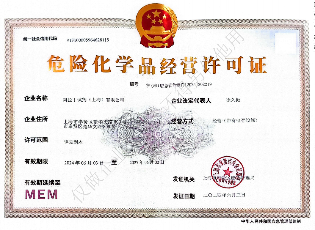 危险品化学品经营许可证(带存储)